
In the East Sussex Record Office at Brighton there is a large map of the properties held by the Manor of South Malling-Lindfield, a very ancient manor that dated back to Saxon times. The map, which was drawn by a surveyor named William Figg in 1829, and is orientated north-south, shows land belonging to the manor in the parishes of Worth, West Hoathly, Lindfield and Wivelsfield, in a continuous sheet at a scale of 1:47,520 (1 inch to 60 chains, if you are curious). Parcels of land are shown in four different colours, denoting the type of tenure: Red for freehold; Grey for leasehold; Yellow for copyhold; and Green for waste. Each parcel has a number which relates to a separate reference book. Below is the portion of the map showing Crawley Down.
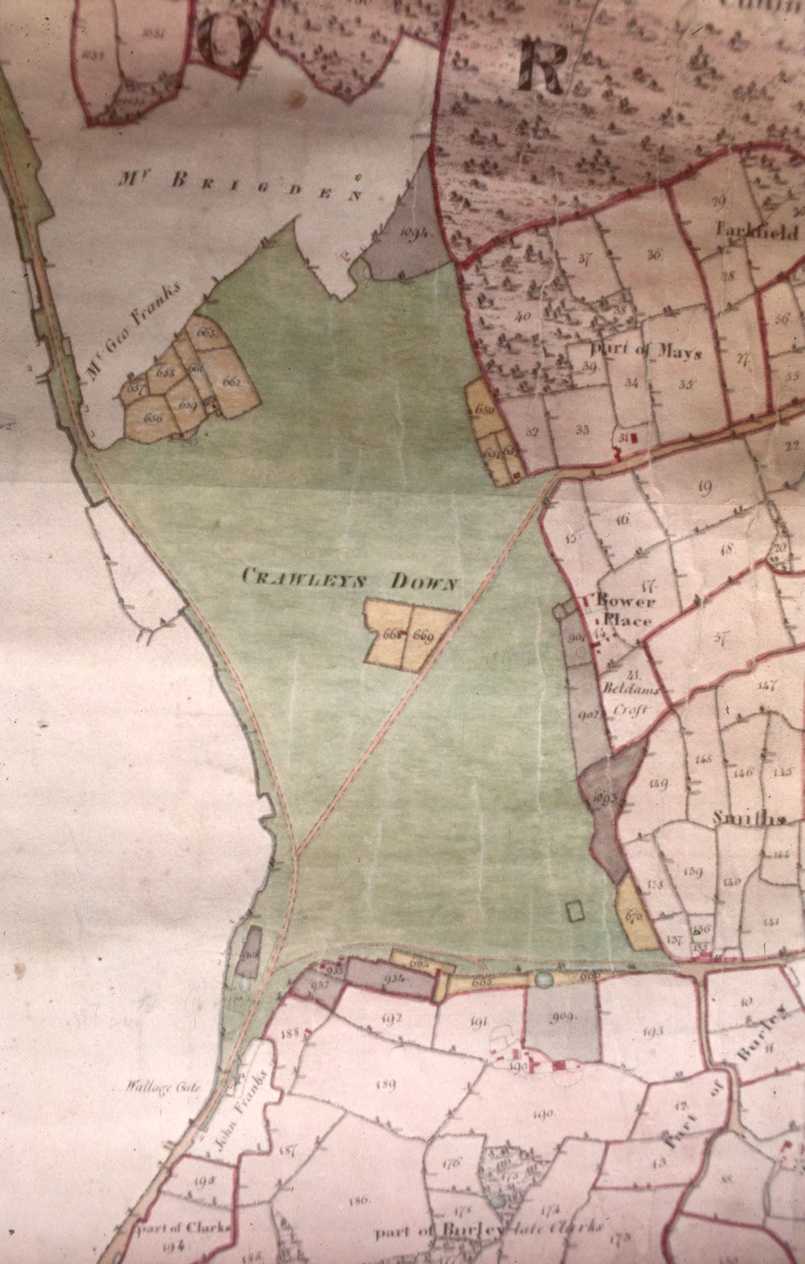
In 1829 Crawley Down, which was sometimes called Crawleys Down or Crawley Downs, was manorial waste – a common. It had first been mentioned in historical documents back in 1274 and was probably waste then. It may have extended further to the north, the uncoloured area at the top of the map, and in 1829 owned by ‘Mr Brigden’ and by Mr George Franks, had evidently been purchased from the manor previously.
We can also see that several small parcels of land, coloured grey and yellow, had been enclosed from around the edges of the waste. The grey ones had been enclosed on long leases back in the 17th century, while the yellow ones were copyholds granted in the 30 or so years before the map was made. Copyholds were a sort of tenancy where the only proof was a copy of the roll of the manor court, and was surrendered when the tenant died. The location of the leaseholds suggests that they were acquired from the lord of the manor to increase the size of agricultural holdings around the edge of the waste, while the copyholds were probably ‘squatter’ enclosures where people had erected dwellings swiftly and then claimed retrospective permission from the lord to enclose land around them. Provided there were no local objections, the lord usually granted a tenancy and he could then claim a rent. In 1829 the lord of the manor was the earl of Chichester who lived at Stanmer Park near Brighton.
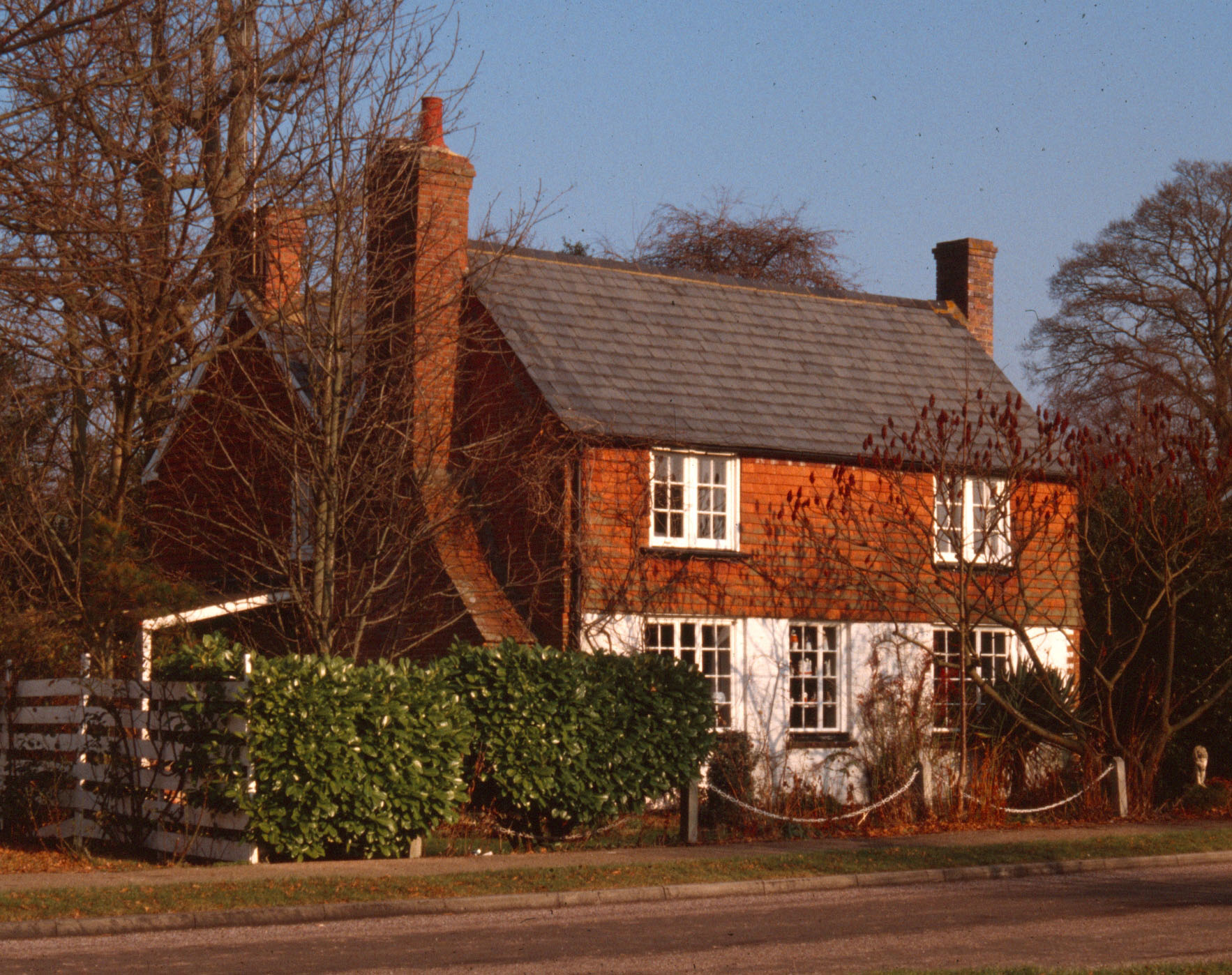
One such copyhold is shown in the middle of the waste with a dwelling on one of the parcels of land. This is Squires Cottage in what is now Squires Close. The Grange is shown to the south of Crawley Down, but not identified by name, even though it was so-called by the 1780s. On the east side of the waste, just south of Bower Place is the intriguingly-named ‘Beldams Croft’. A beldam was an old woman, a grandmother or, less respectfully, a witch or hag. I wonder which definition this piece of land relates to and when was it so-named. It is evidently part of the freehold of Bower Place farm so it is likely to be a field name of ancient origin. The earliest mention of the word in the Oxford Dictionary is from the 15th century. Down on the left side of the map, where the waste peters out, you should be just able to make out ‘Wallage Gate’. This was the toll-gate on the turnpike that ran from New Chapel (between East Grinstead and Blindley Heath) down to Brighton. William Cobbett (1763-1835), the journalist and social reformer, wrote in his Rural Rides (1822) that this road was ‘by far the pleasantest coach-road from the WEN to Brighton’. The WEN (i.e. a wart or tumour) was Cobbett’s sarcastic word for London. At the Wallage Gate, travellers on horseback or in waggons would have to pay a charge for the distance to the next toll-gate, like you do if you go over the Dartford Crossing or travel on French motorways. The gate was later moved to the top of Wallage Lane, and the turnpike was abandoned completely in the 1880s.
Apart from the turnpike, the only roads across the waste in 1829 were what is now Vicarage Road and one along the southern edge of Crawley Down which no longer exists. From the map we can get no indication of what vegetation there was. Was it heath, with furze, or gorse bushes, like Ashdown Forest, or was it wooded like the surviving remants of Copthorne Common? Presumably there would have been areas of grass as the tenants that lived close to the waste would have used it to graze animals, and I suspect that the universal need for wood for domestic heating and other uses would have meant that this patch of waste would have been largely devoid of mature trees.